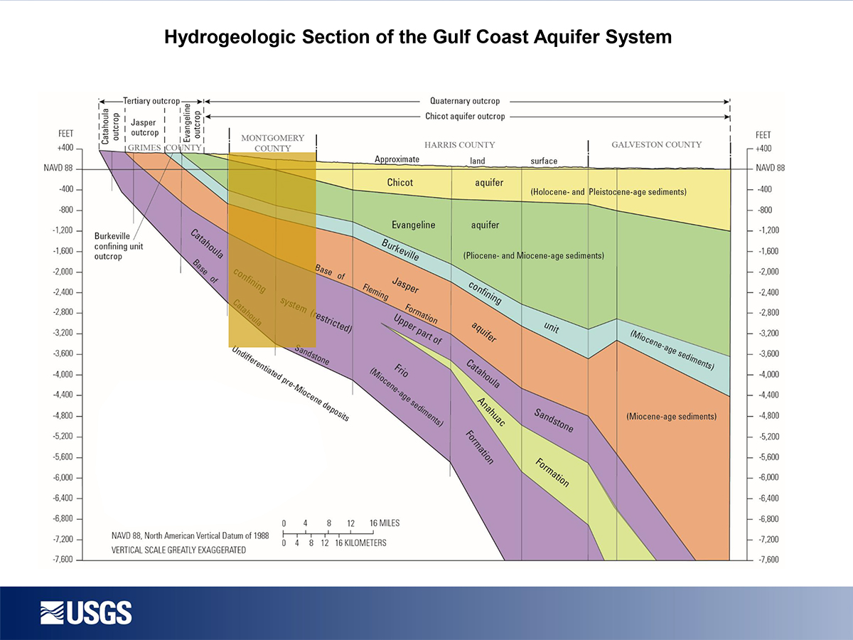
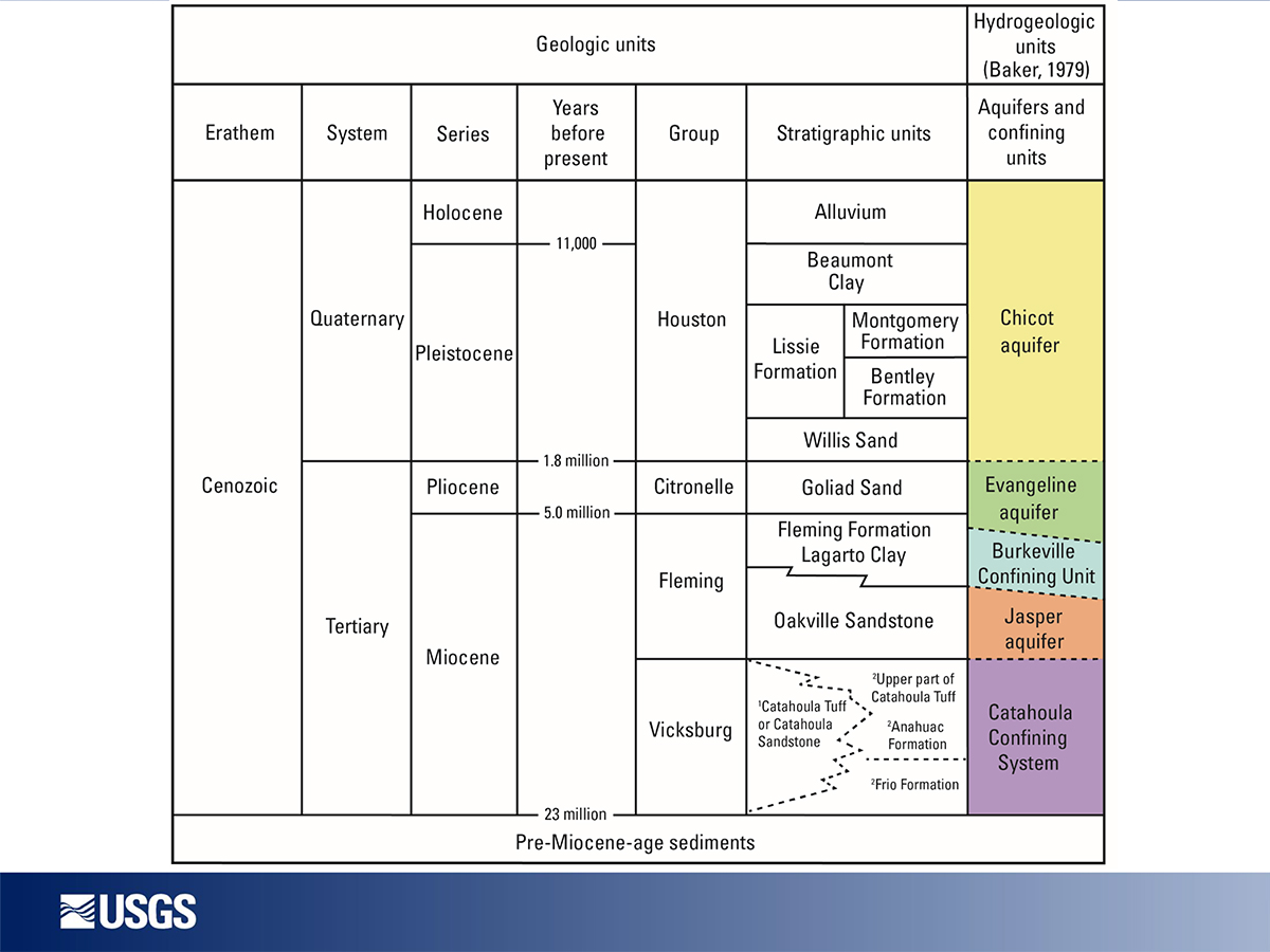
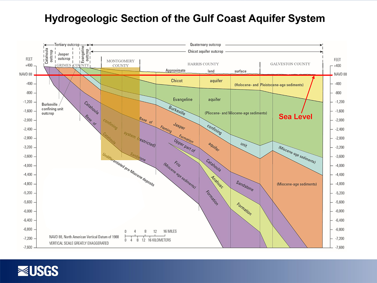
Gulf Coast Aquifer

The Gulf Coast Aquifer is a major aquifer paralleling the Gulf of Mexico coastline from the Louisiana border to the border of Mexico. It consists of several aquifers, including the Jasper, Evangeline, and Chicot aquifers, which are composed of discontinuous sand, silt, clay, and gravel beds. The maximum total sand thickness of the Gulf Coast Aquifer ranges from 700 feet in the south to 1,300 feet in the north. Freshwater saturated thickness averages about 1,000 feet.
Water quality varies with depth and locality: it is generally good in the central and northeastern parts of the aquifer, where the water contains less than 500 milligrams per liter of total dissolved solids, but declines to the south, where it typically contains 1,000 to more than 10,000 milligrams per liter of total dissolved solids and where the Gulf Coast Aquifer productivity of the aquifer decreases. High levels of radionuclides, thought mainly to be naturally occurring, are found in some wells in Harris County in the outcrop and in South Texas.
The aquifer is used for municipal, industrial, and irrigation purposes. In Harris, Galveston, Fort Bend, Jasper, and Wharton counties, water level declines of as much as 350 feet have led to land subsidence.
The Catahoula Aquifer is considered an Alternative Water Source (AWS) in Montgomery County.